Your Property Management company is ready to save time and money with a better set of maps for your project. You have grown out of the original CAD drawings and it’s not doing what you need it to do. You are spending more time looking for information on where things are or describing details that just take too long. Using Google maps to supplement your CAD drawings has been helpful but it is missing key points. A new set of accurate Aerial Property Management Maps of your Property is on your to do list.
Using current aerial imagery is the core starting place for your new set of Property Management maps. With several sources to choose from we pick the best image for your property. Next comes the overlays. They are the items that are missing from your supplemental Google maps image.
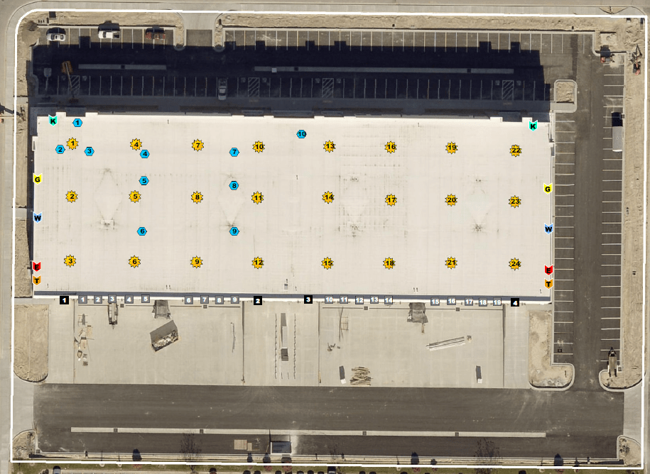
First we incorporate street names on the aerial image. Followed by the parcel boundaries obtained from the county. Depending on the property type we can start layering in useful items. Parking lot stalls, SF of asphalt, building access points, dock or ground level doors, HVAC units, utility shutoffs. All the items that you might need quickly for daily maintenance.
Now that you have a current image showing the building property along with some of the overlays noted above you can see the project as it sits today. This map can be shared with your maintenance crew to locate the correct location where a reported issue. Reducing time spent searching and resulting in money saved.
Read more about our Property Managemnet maps HERE. OR visit us at https://mapsynergy.com/property-mgmt