The Biggest Skimap Update Yet 2026
The Biggest Skimap Update Yet
This summer I rebuilt Skimap from the ground up. The maps you know are still here, just as accurate as ever, but there’s a lot more you can do with them this season. Here’s everything that’s new.
Rebuilt on a new mapping platform
Every map now runs on the latest version of the ArcGIS mapping platform all loaded into Skimap.com. It loads faster, looks cleaner, and works better on your phone. Tools tuck themselves out of the way while you’re using them, so the map stays front and center.
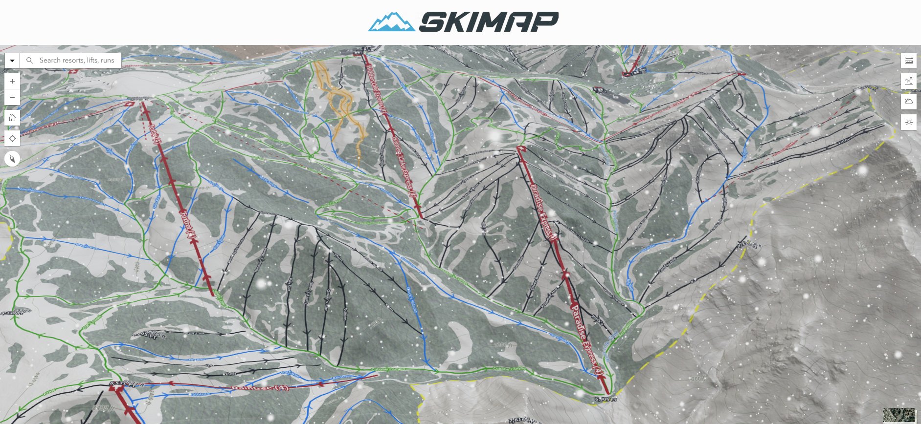
3D resort maps
Tilt, spin and fly over every run and lift on real terrain. It’s the best way to understand a mountain before you ski/ride it. You can switch between my custom map and high-resolution satellite imagery with one tap.
Live weather, snow and avalanche data (US)
A new Weather panel on both the 2D and 3D maps brings it all together:
- Radar: the last 4 hours of precipitation, updated every 5 minutes. Hit play to watch storms roll in.
- Winter weather alerts: blizzard, winter storm, ice storm and extreme cold warnings from the National Weather Service.
- Avalanche danger: today’s official forecast for every US avalanche zone, color-coded on the North American danger scale, with a link to the full forecast. Forecasts start when the avalanche centers open for the season, so zones show grey until then.
- Snow depth and snowpack: NOAA’s national snow analysis, updated four times a day.
On the 3D map, all of it drapes right over the mountains.
New tools
- Elevation profiles: tap any run or lift to see its vertical drop, steepness and length, or draw your own route.
- Measure distance: plot a route with as many points as you like and get the distance, the distance along the slope, and the total climb and descent.
- Find Me: one tap shows where you are on the mountain.
- Daylight & sky effects (3D): move the sun through any season to see which slopes sit in shade, or make it snow.
Offline maps: your Skimaps have a new home
If you bought my maps on Avenza, here’s what happened: Avenza has closed its map store to publishers. I can no longer update my maps there or add new ones. It’s been frustrating, but it pushed me to build something better.
The GeoPDF Season Pass gives you this season’s updated offline maps for every resort in one purchase. Download the resorts you want and keep them. They open in the free ArcGIS Field Maps app on iPhone and Android, with no account and no subscription needed. They work with no signal, and your GPS shows where you are.
Coming from Avenza? Use code AvenzaMigration20 for 20% off a GeoPDF Season Pass. Valid Oct 1, 2026 to December 31, 2027
New plans for the season
- Essential (Free): 2D trail maps for every resort.
- Premium Monthly, $3.99: everything interactive, for a trip.
- Premium Season Pass, $9.99: everything interactive for 5 months, with no subscription hangover.
- GeoPDF Season Pass, $12.99: offline maps for every resort, yours to keep.
- All-Access Season Pass, $17.99: all of it, online and offline.
Thank you
Skimap is still made by one person, and every map is still drawn by hand. Many of this year’s improvements came from your feedback and corrections, so keep them coming. See you on the mountain.
— Matt, The Map Guy