Tag: GIS
Mapping Out Legal Descriptions
We have been spending a lot of time lately helping people figure out exactly where certain legal descriptions are located. So much so we thought we would dive in and explain what they are and how understanding where they are can help you understand the bigger picture. Legal Descriptions So what is a legal description?…
Read MoreCase Study-Maps in the Legal Industry
We find maps are needed in a lot of different professional areas. In this post we will explore a new area that is quite intriguing to us. Maps in the Legal Industry. Not what you were expecting? Let us dig a little deeper into this topic. Or primary exposure to maps in the Legal…
Read MoreTrade Area Basics – Part 4, The Example
Now that you have seen trade area basics of how they are created, how can you effectively use them? Remember that trade areas are a subjective thing that can be adjusted on the fly when new data is presented to the equation. So lets start adding more data to see if our trade area approach…
Read More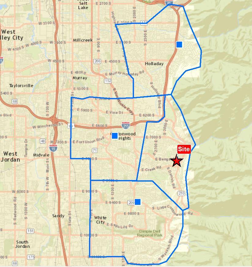
Trade Area Basics – Part 3, The Trade Area
Step three of our example set continues on with Trade Areas. We will focus on the art of designing a potential trade area based on multiple variables. Straight distance or a radius, drive times, mental barriers and taking into account other locations. The Trade Area We take the best of all variables and draw what…
Read More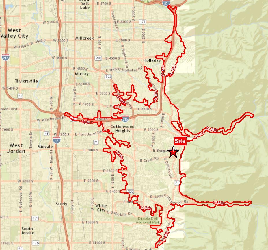
Trade Area Basics – Part 2, The Drive Time
Step two in our Trade Area Basics is the Drive Time. The Drive Time takes a center point or site and runs through a road network to find acceptable routes a driver can traverse within set times. The Drive Time Basically this is done by accessing road type and an associated speed for each road…
Read More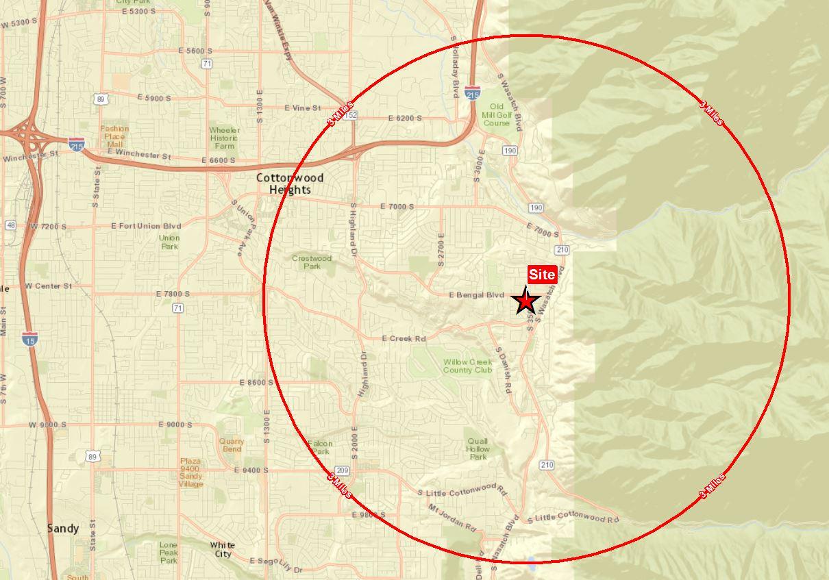
Trade Area Basics – Part 1,The Radius
Trade areas are not a new thing by any means but they are often misunderstood. Sure they are a way to show where people tend to be based on location and distribution of target locations. Most people start with a simple Radius. The Radius While this is useful in a simple yet standard setup, it…
Read More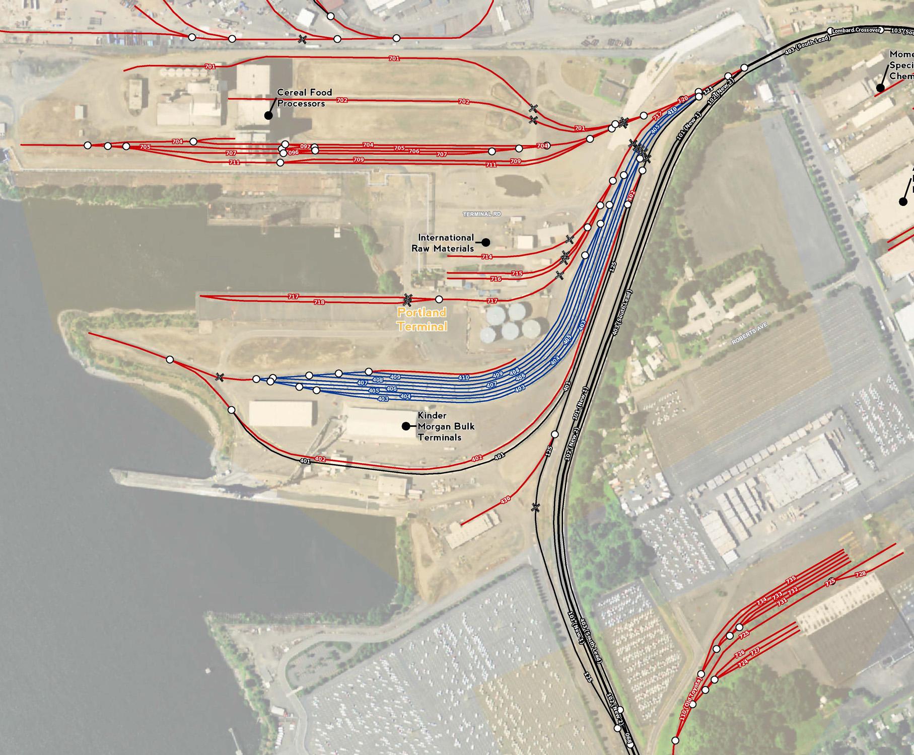
Maps Everywhere
We never thought we would be making maps everywhere including for a rail yard operated by a huge rail road. But here we are doing just that. This is a great example of an established company who does the same thing every day over a very long time that stops and says what if we…
Read More