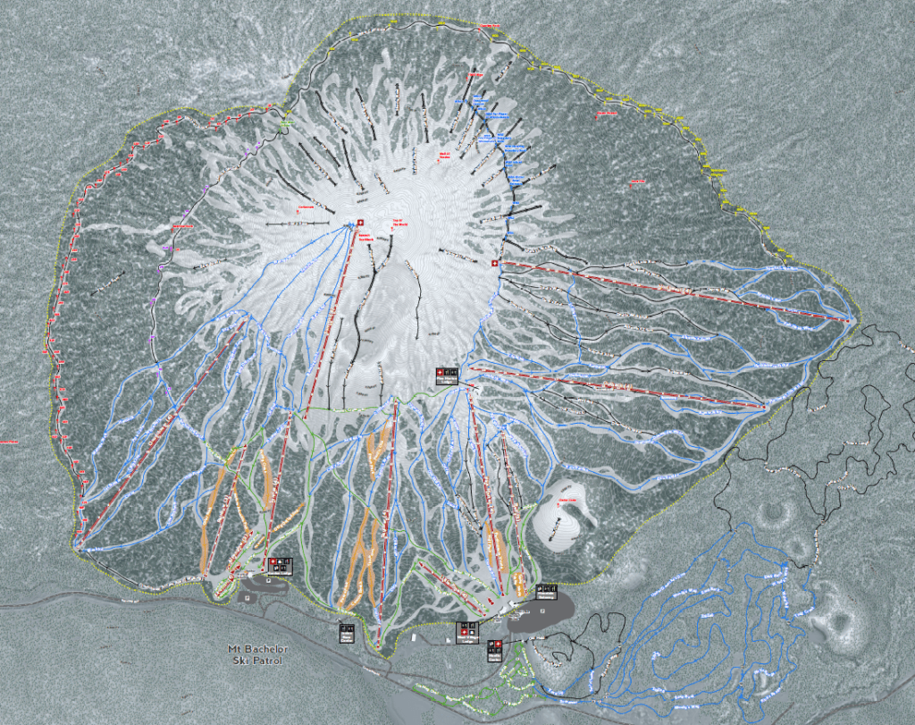
We recently posted about our one of a kind skimaps. Ski Patrol needs greater accuracy than the average skier or boarder on the mountain. Can they leverage our highly accurate ski maps to assist in everything from daily tasks to rescues? Yes they can. Here are some details on our Ski Patrol Maps.
Ski Patrol has a lot of moving parts. New members come on board yearly and need to learn the mountain. How do you transfer all of the information needed quickly so it can shorten their learning curve? By indexing all of that information on one accurate map and putting it on their phone for use on the field. Oh and our skimaps are GPS accurate even without a network connection. We leverage the Avenza Maps platform.
Sample Map Breakdown
Our example map is Mt. Bachelor in Oregon. Here are some of the items that individual patrollers requested to add to our existing base.
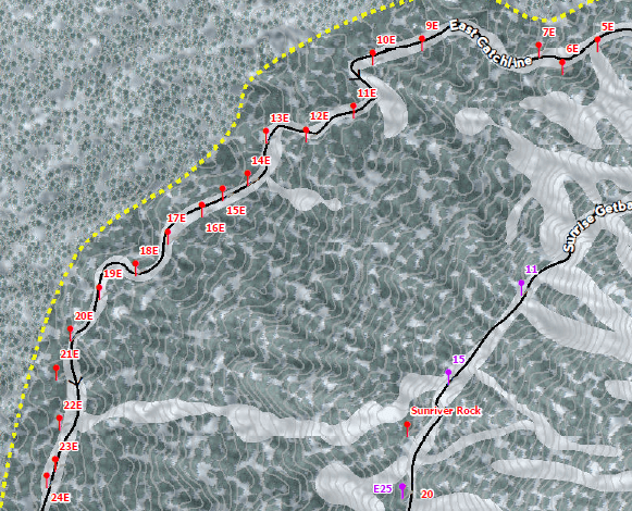
With Mt. Bachelor being a Volcano, you don’t want to ski too far and miss the way back. On their catchline they have located markers along both sides in assisting in rescues. This ensures when a call goes out patrol can see where they are and navigate to the correct location.
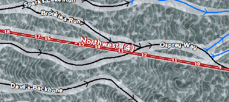
Knowing where you are in location to a fixed position like towers can be useful. Like sign placement along a lift. Slow signs need to be placed on tower 12. And fix the pads at tower 9.
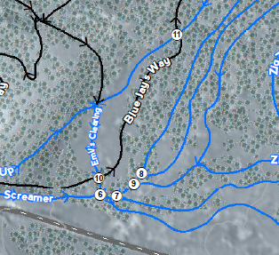
With Nordic skiing knowing what intersection you are at is very helpful. Especially when they all look alike and can be clustered like our example.
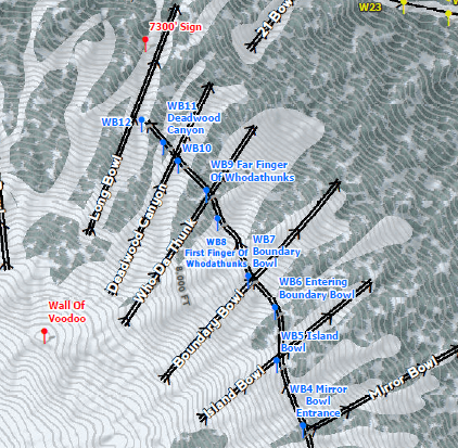
Finally, patrol has locations that are only relevant to their operations. Say sled locations or access points to areas. All of these locations can be supplied with GPS locations from any device.
Want one for your Patrol? Contact us. See more on our skimap platform here. And read more on our ski topics here.