Tag: maps
Skimap Roundup for 2025-26
670 Resorts covering the United States, Canada, Australia, New Zealand and United Kingdom 31,759 Named Runs 4,469 Lifts 368,233 Mapped Acres 293 resorts had some kind of map change for the season. Expansions, New lifts, New Named Runs, Relocated Terrain Parks, Parking and Amenity Improvements to name a few. That’s over 43% of the resorts…
Read MoreUsing Maps to make money in Commercial Real Estate
Using maps in Commercial Real Estate is key to communicating all the most important items of the deal. How you deliver that information comes in many forms from screen shots from your favorite free map platform, Adobe design, to using a full GIS. Lots of options for different costs and level of detail. If you…
Read MoreMapping out HOA’s
At a HOA meeting a while back we were discussing the ways to use Maps and GIS in new ways with several associations and managers. The topic came up that the existing HOA Maps they had on hand were either original plat maps or screen grabs from google maps. Neither option satisfied their needs and…
Read MoreNavigation Challenges
We have spent a lot of time riding chairlifts lately and we have been noticing one glaring item from our short term friends on the chair. While everyone is trying to figure out where to go next they are having navigation challenges in where they are vs where they want to be. Now imagine the…
Read MoreCase Study-Maps in the Legal Industry
We find maps are needed in a lot of different professional areas. In this post we will explore a new area that is quite intriguing to us. Maps in the Legal Industry. Not what you were expecting? Let us dig a little deeper into this topic. Or primary exposure to maps in the Legal…
Read More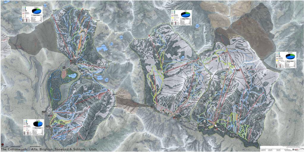
New and Improved Ski Maps for 2016-17
Don’t let this nice autumn fool you, winter and all the wonderful snow sliding weather will be here soon. That means it’s time for us to highlight the improvements to our growing Ski Maps Collection for 2016-17. First off we have expanded our Ski Map coverage to include 73 different resorts. Add to that 7…
Read MoreTrade Area Basics – Part 4, The Example
Now that you have seen trade area basics of how they are created, how can you effectively use them? Remember that trade areas are a subjective thing that can be adjusted on the fly when new data is presented to the equation. So lets start adding more data to see if our trade area approach…
Read More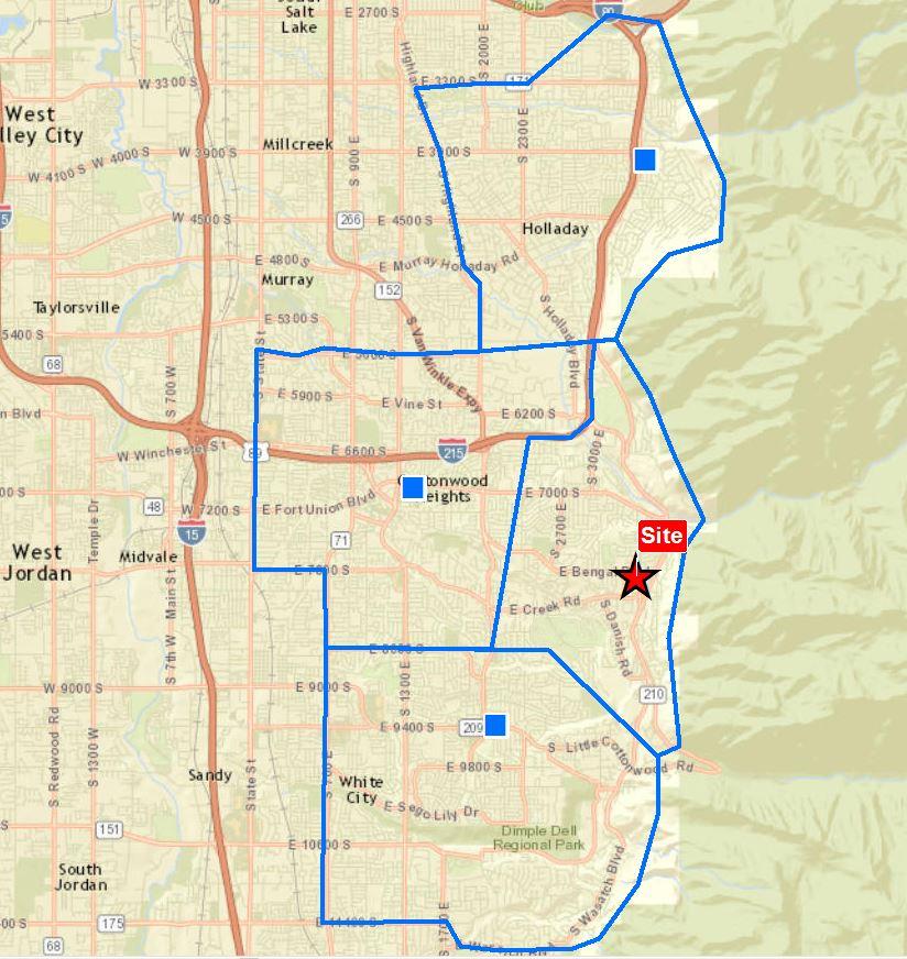
Trade Area Basics – Part 3, The Trade Area
Step three of our example set continues on with Trade Areas. We will focus on the art of designing a potential trade area based on multiple variables. Straight distance or a radius, drive times, mental barriers and taking into account other locations. The Trade Area We take the best of all variables and draw what…
Read More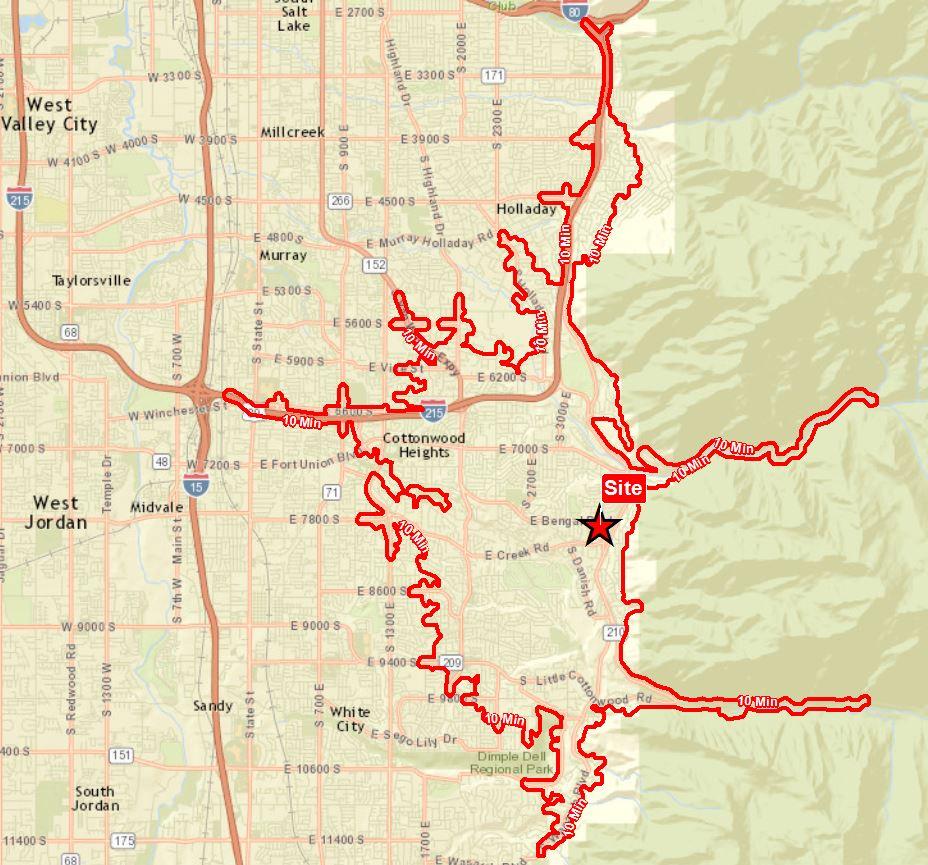
Trade Area Basics – Part 2, The Drive Time
Step two in our Trade Area Basics is the Drive Time. The Drive Time takes a center point or site and runs through a road network to find acceptable routes a driver can traverse within set times. The Drive Time Basically this is done by accessing road type and an associated speed for each road…
Read More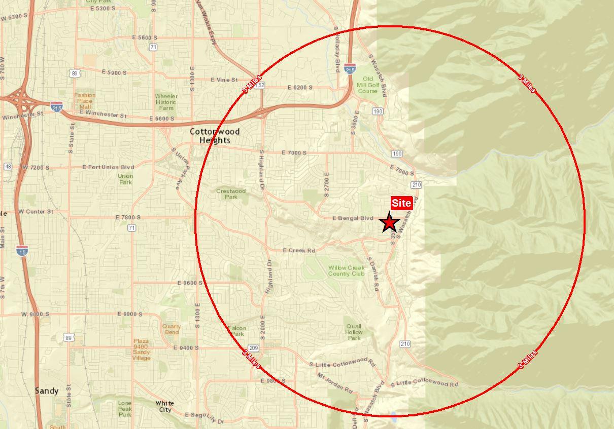
Trade Area Basics – Part 1,The Radius
Trade areas are not a new thing by any means but they are often misunderstood. Sure they are a way to show where people tend to be based on location and distribution of target locations. Most people start with a simple Radius. The Radius While this is useful in a simple yet standard setup, it…
Read More