Using Property Maps to save money in Real Estate/Property Management
Using property maps in real estate/property management is key to communicating all the most important items of the property. How you deliver that information comes in many forms from screen shots from your favorite free map platform, Adobe design, to using a full GIS. Lots of options for different costs and level of detail. If you are looking for the latter option here are some options that might be of interest that could help your business.
We will be showcasing two types of map products. Print Format Maps and Interactive Maps.
Specifically we start with the following deliverables.
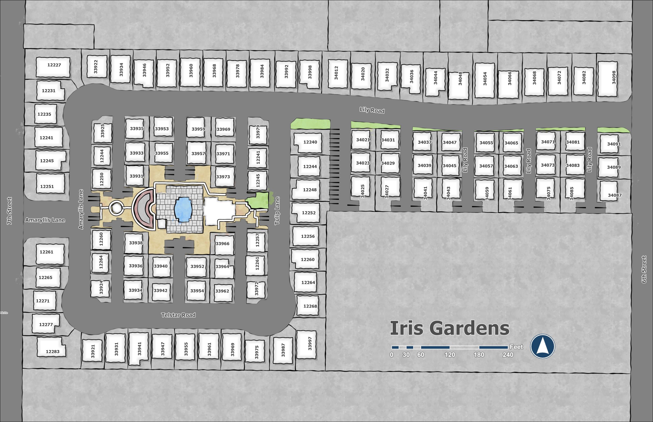
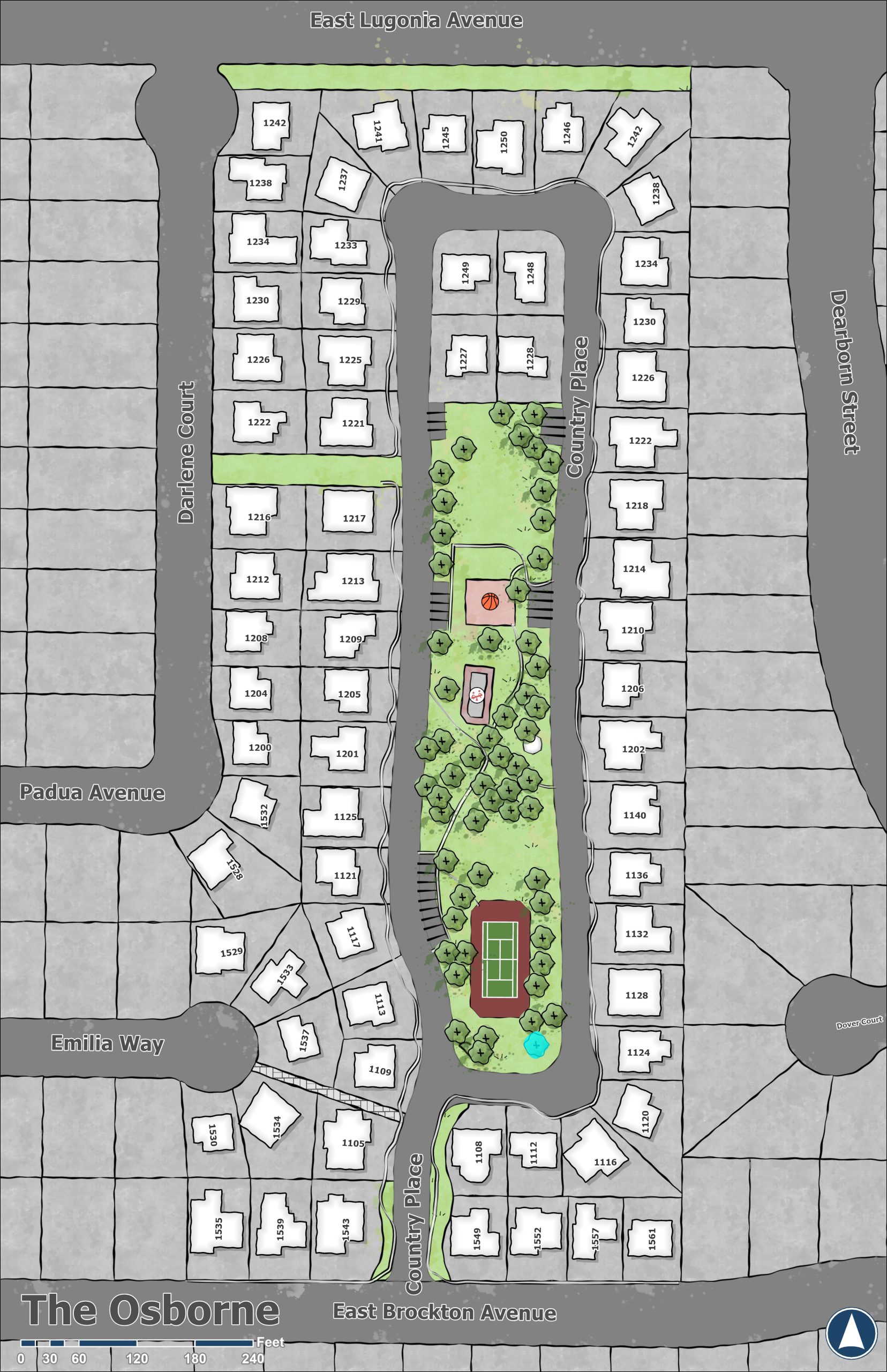
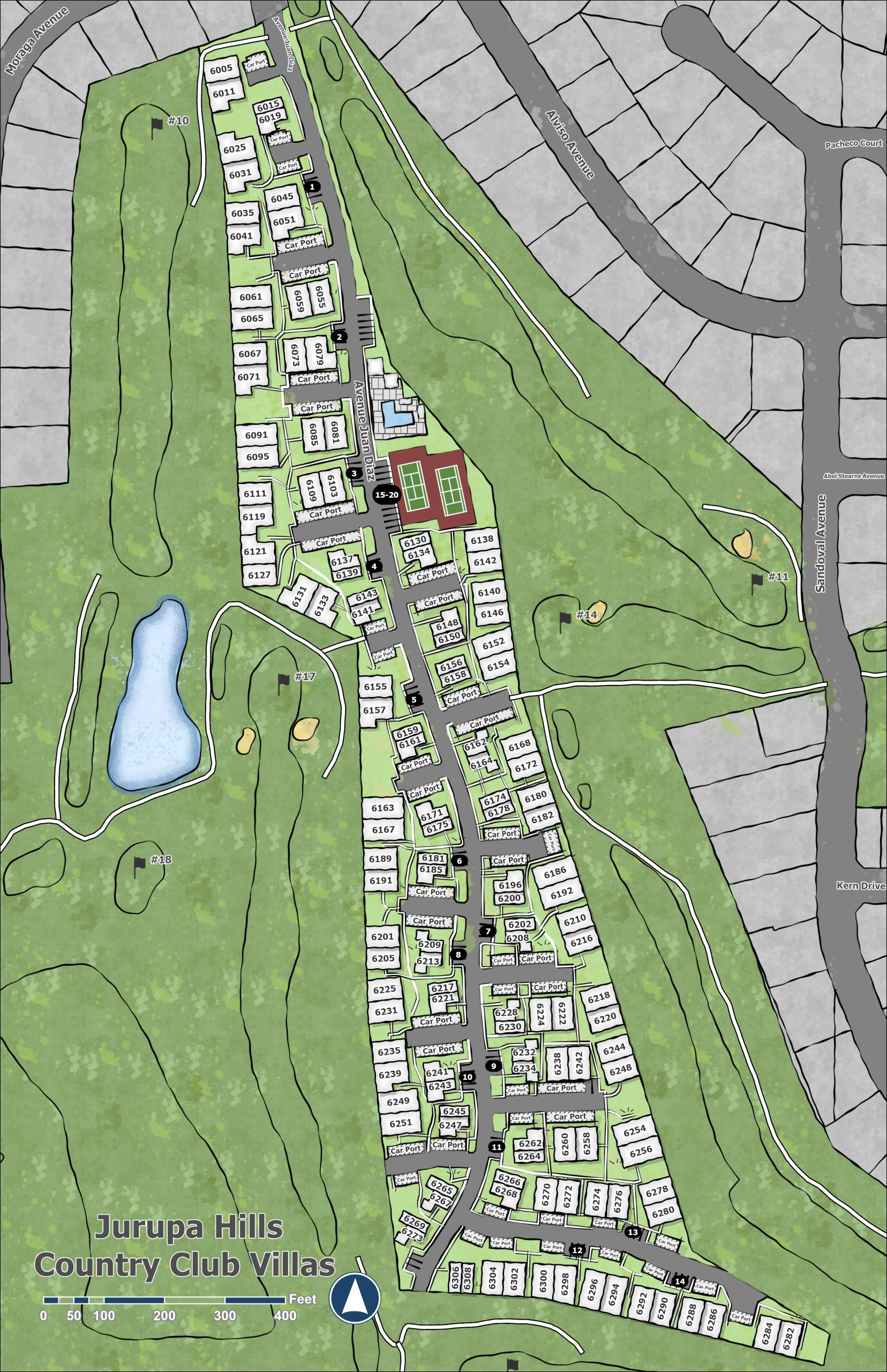
Clean Custom Property Map
If imagery isn’t your preferred approach your property can be rendered as a Clean Custom version. Easily sizeable to any area. Focusing on what you want to stand out for your property.
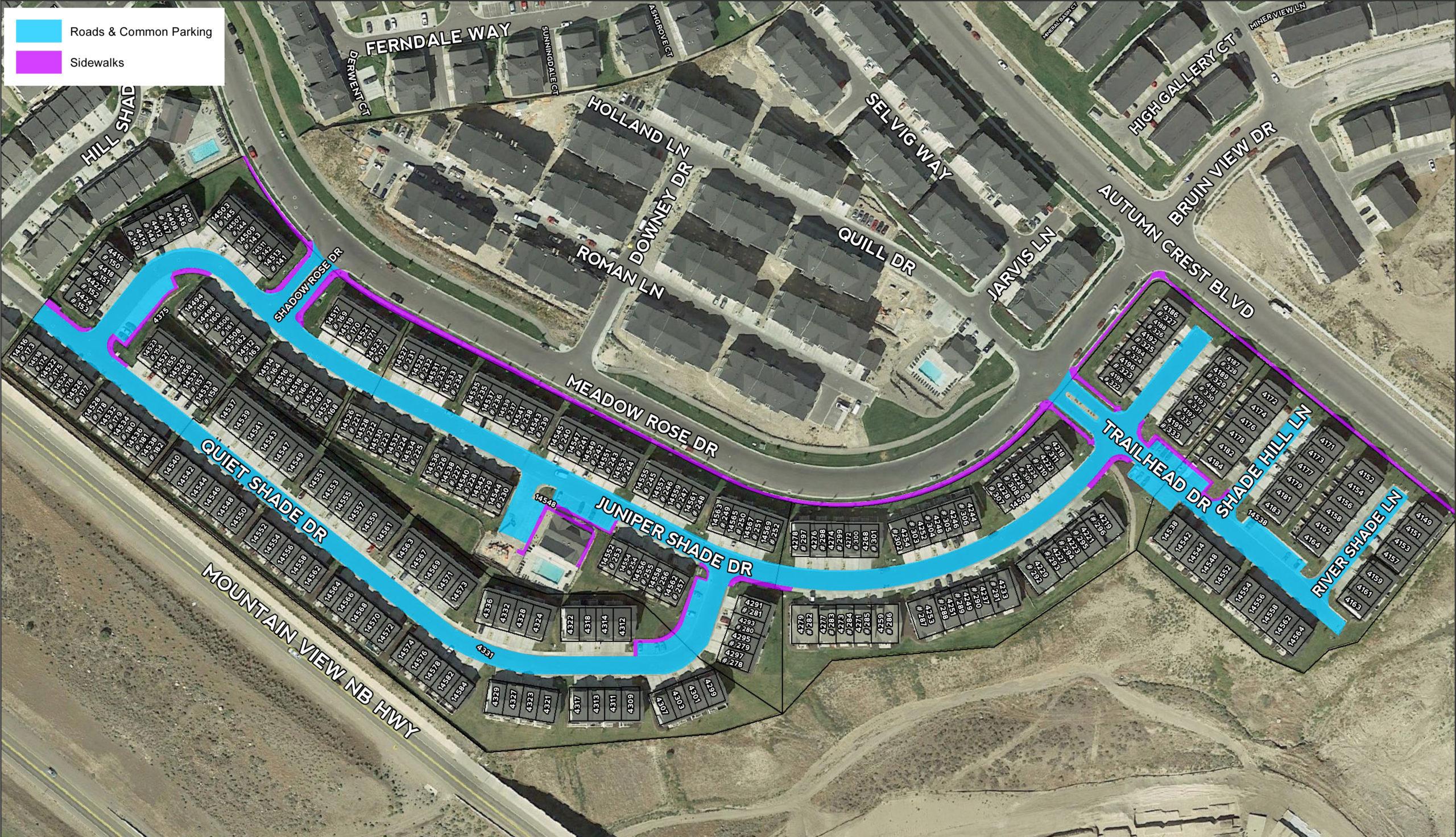
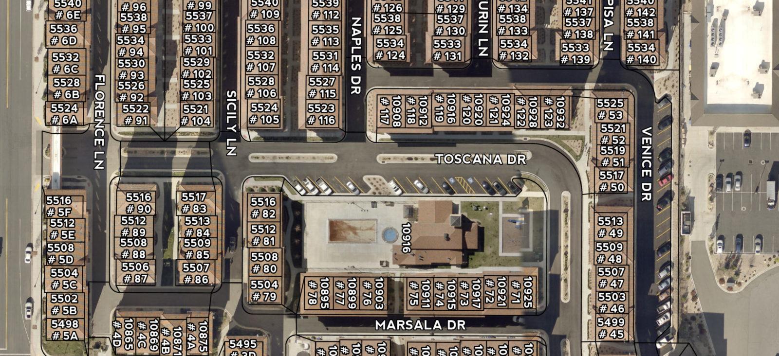
Aerial with Parcels
Using a GIS you have the ability to bring in current parcels and streets automatically. Using this data you can populate the labeling of each parcel with unit and address information. Manual placement of these labels for easy reading helps readability. Multiple imagery provider options can further add to the completeness of the map.
Aerial Landscape Map
Starting from the previous Aerial with Parcels map we can now add landscaping areas based on the parcels and imagery. Area or SF can be calculated if needed.
Aerial Snow Removal Map
Continuing from the previous Aerial with Parcels map we can now add snow removal areas based on the parcels and imagery. Area or SF can be calculated if needed.
Sprinkler Zones
Sprinkler example with zones and types of watering methods. Can be used to quickly find the right zone for shutoff and repair.
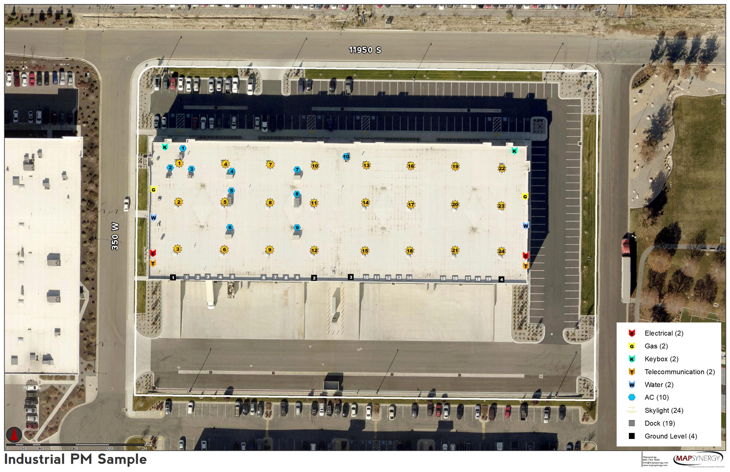
Access Points
This industrial sample was crafted to show the locations of key points. Shutoffs for gas, electrical, keybox, telecommunications, water and AC to name a few.
We showcase all the ways you can save time and money in managing your HOA here.