Using Webmaps and mobile apps to speed sales.

Mapping Your Project
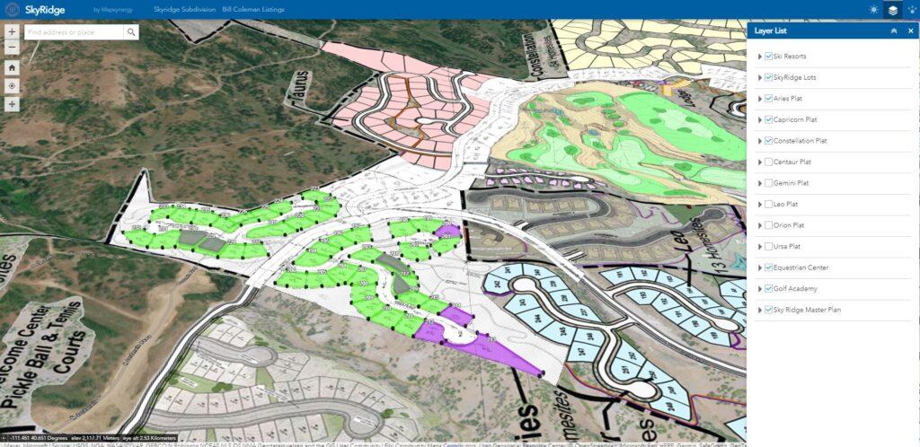
Accurately showing New Residential Development projects brings unique challenges. Showing your buyers exactly where each lot is, what surrounds it, where the roads will be what the master plan layout will look like and what the buildable area is can be daunting. Especially when very little of the development may be built or even under construction.
Starting from your plat we can render in each lot in high accuracy showing each parcel, lot corner and dimensions. Highlighting exactly what each lot will look like on top of the plat or master plan displayed over an existing aerial.
More importantly each parcel is clickable with information about that lot. From address, lot number, acres, price, lot status or availability. Links to your pictures of the lot or dedicated website per location can be added for added dimension. Additional fields of information can be added to fit your needs. All of these fields for each lot can be changed at any time by you or your team through a dedicated app. Adding flexibility to change as needed on the fly.
All of this easily displayed in a dedicated map for the public to see your available property.