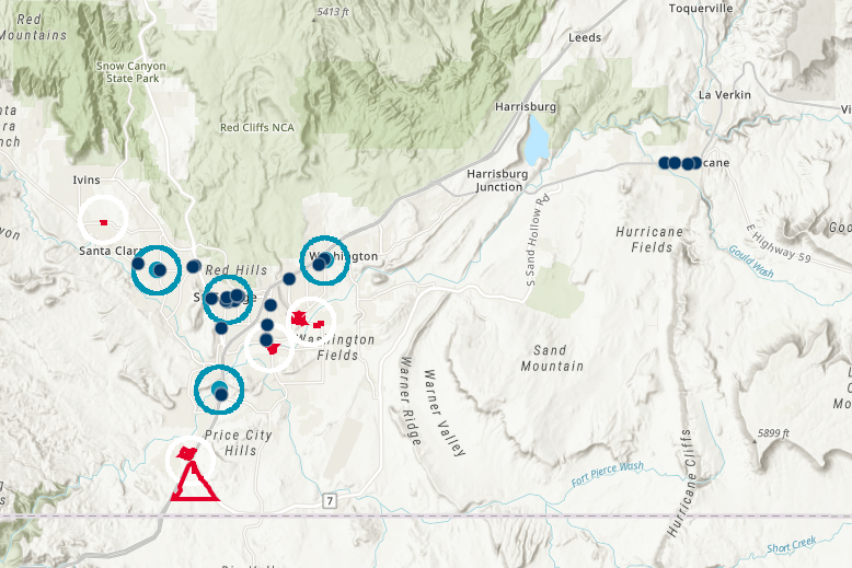
Expanding on our previous commercial real estate webmap examples we dive into a sample dataset of retail site selection. This time we are looking for a site for an existing bank.
To keep things simple in this process we have compiled four different datasets that will help assist our hypothetical bank client in getting a better look at the expansion options. You can follow along here.
To start our sample client Chase Bank is looking to expand and wants to see where they are currently located in a market. Competition is important so we add all other banks in the area to the map as a new layer that is clickable for more information.
Next we show the tour locations that are available. Each new potential area has multiple possible sites that each has potential. All named and numbered for easy identification. More site information can be added like a picture ore link to the flyer.
Finally they like to have some distance between their locations so we overlay a 1 mile ring around each existing location to ensure sites are far enough apart. This ensures that any new location will not dramatically impact an existing location. This also applies to the tour locations as well as a different color to show proposed service areas.
Now you can show all of this on fixed map or PDF. But with all of this info being on one webmap we can see the entire overview of the market down to the exact sites. One stop shop for quickly making decisions for the client, saving time for all parties.
Interested in seeing how this can improve your retail site selection process? Contact us below. Read more of our real estate mapping options here.